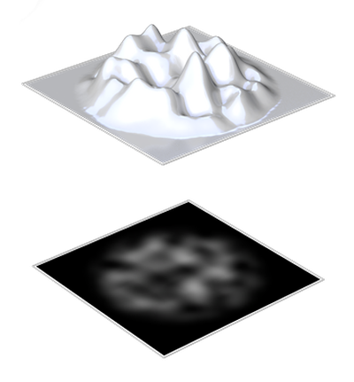
heightmap generation
For the creation of heightmaps existing elevation data gets converted to grayscale or completely random landscapes get generated. Programs that visualize the grey values of the heightmaps directly as a 3D model simplify the development. With various noise functions and manual adjustments, realistic landscapes can be generated.
Show all